
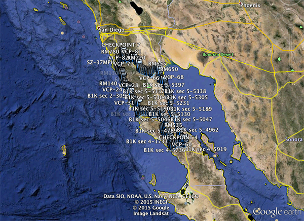
 SCORE has released the preliminary GPS file of the Baja 1000, which means I’ve been flying the course in Google Earth.
If you want to see what the course looks like by “flying” it, here’s what you do:
- Download the baja10002015KML file.
- Launch Google Earth.
- Open the KLM file in Google Earth.
- On the Google Earth sidebar on the left, look for the “Places” section and under it look for “GPS Device”. Make sure the box mark next to it is checked.
- Click the small triangle to the left of “GPS Device” so that a menu appears underneath it. It looks like this:
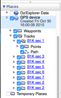
- Click the triangle to the left of “Tracks”
- Click the triangle to the left of “B1K sec 1”
- Click on “Path”
- Click this button
 down below the “Temporary Places” listing.
 - You’ll have to repeat the process for each section of the course – “B1K sec 2”, “B1k sec 3”, etc.
That should get you flying.